Our networks of transportation and mobility play a critical role in ensuring public access to the coast. Today, maintaining and improving these connections is more critical than ever as we face challenges like climate change, sea level rise, and environmental justice and the affordability of the coast. But increasingly, how people move along the coast is also critical to ensure a coast accessible for all. Building robust multimodal transportation networks, improving coastal trail networks, and expanding access for all are essential priorities for the Coastal Commission. The Commission’s Transportation, Access, and Mobility Program leads the agency’s efforts to ensure the resiliency of our critical transportation and public access infrastructure, advance smart growth, and expand multimodal transportation facilities, all while expanding public access to and along the coast.
The program stems from a visionary partnership with Caltrans that started in the early 2000s and aimed to ensure that both agencies could meet California’s burgeoning transportation demands while enhancing natural resources and maximizing public access for all. Through close collaboration with Caltrans and other partners, the program reviews and advances transportation and mobility plans and projects in the coastal zone, including highways, roads, complete streets improvements, multimodal paths, and coastal trail segments. The program’s central goal is to increase coastal access for all—across different transportation modes, socioeconomic groups, and regions of the state. The program also extensively works in large habitat mitigation projects, setting aside many acres for habitat restoration and preservation, and works to expand advance mitigation opportunities.
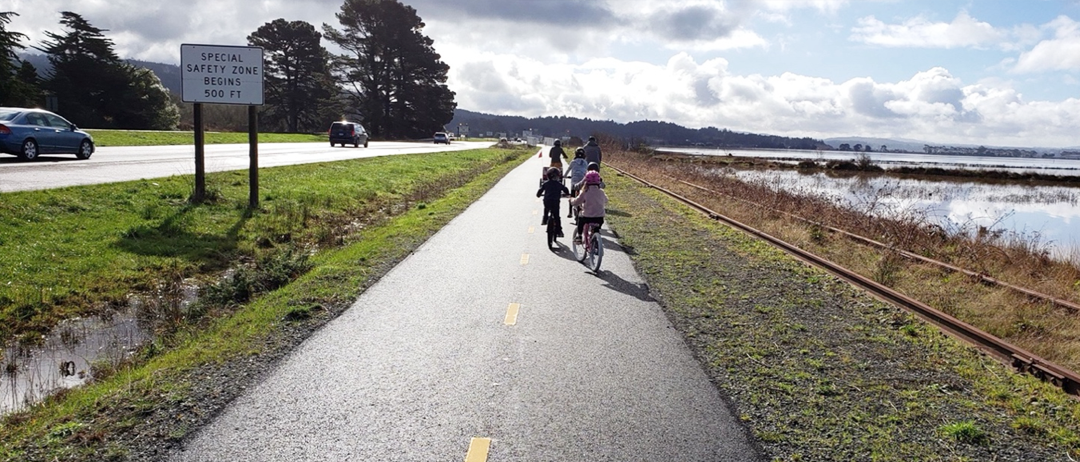
Humboldt Bay Trail between Eureka-Arcata. The Commission supports funding, permitting, and advancement of this rail trail network around Humboldt Bay as well as removal of unsightly billboards.
Cycling and pedestrian access have been integral to the Commission’s public access mission since its founding.
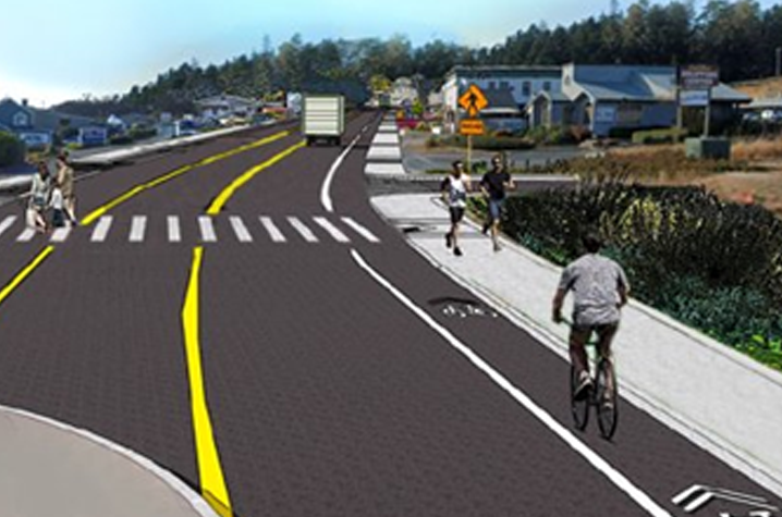
The Commission’s Transportation, Access, and Mobility Program works to advance the agency’s larger goal of expanding multimodal and active transportation networks in the coastal zone. The program led or supported development and approval of some 40 complete street projects from 2020 to 2025. More generally the program has led the creation of some 85 public access improvement projects from 2015-2025. Just in 2024 and 2025, the program has advanced important multimodal projects such as the Eureka Broadway Complete Streets, San Mateo Bike lanes, Gualala sidewalks and bike lanes, Shell Beach Multimodal, Long Beach bike lanes, and others.
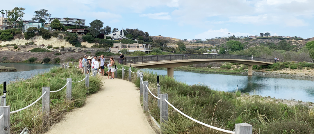
The Commission also regularly works to require expanded multimodal coastal access in large transportation projects, such as this new pedestrian bridge and trail at San Elijo Lagoon required as mitigation for I-5 North Coast Corridor project in Encinitas.
The Transportation, Access, and Mobility Program collaborates with state and local partners to develop new bike paths and bike lanes, pedestrian bridge crossings, crosswalks, pedestrian connections and other complete street elements. This is accomplished through collaboration with the state active transportation programs, Caltrans districts, the State Coastal Conservancy, and with local governments and other local partners.
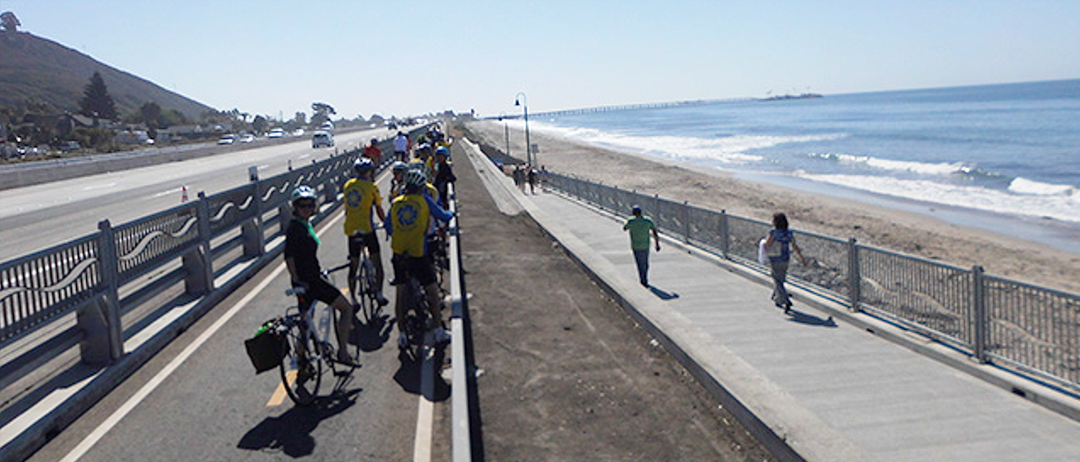
The Commission advanced the Rincon Multi-Use Trail in Ventura.
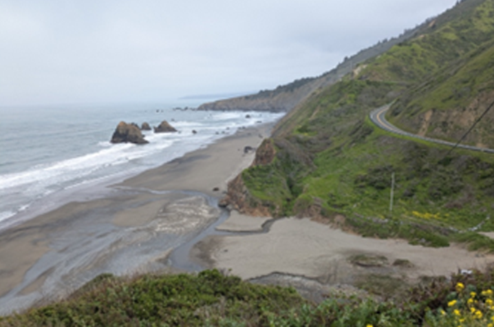
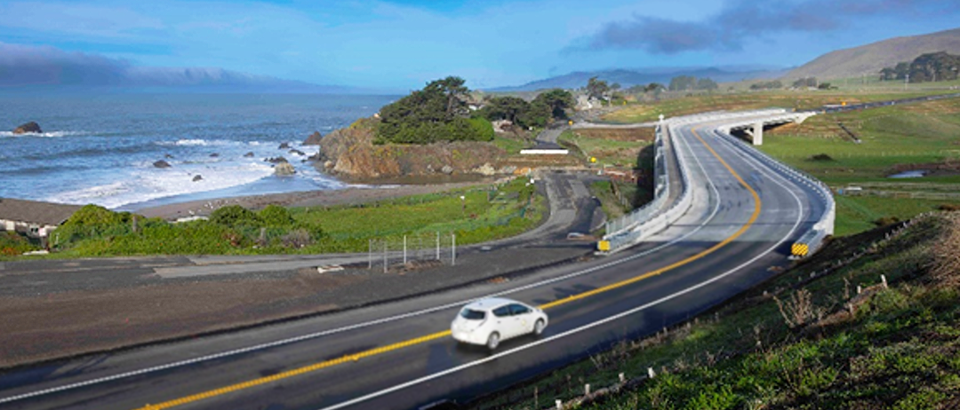
The program has also led several major realignment or managed retreat projects that converted old coastal highways into coastal trails providing additional coastline access for bicyclists and pedestrians such as the Devils Slide Coastal Trail, Piedras Blancas, and Gleason Beach.
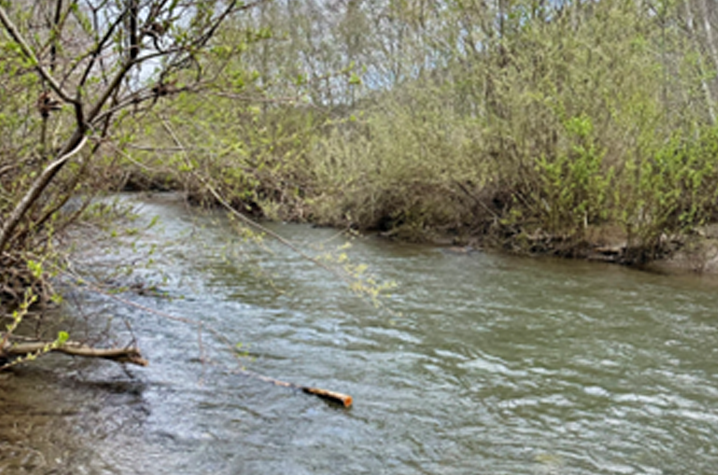
The Commission is a leading partner in the Scott Creek Resiliency Project in Santa Cruz County that will adapt Highway 1 to SLR while removing highway impediments to connectivity, fish passage, and dune formation, and improving multimodal and public access.
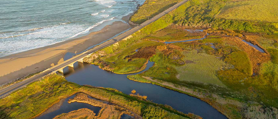
The Commission’s Transportation, Access, and Mobility Program is leading the development of some of the nation’s most ambitious resiliency projects for transportation networks. Many of which are highlighted in this story map developed in collaboration with NOAA and Caltrans: California’s Resilient Coastal Roads Storymap. These projects ensure continued access to our coast while meeting the urgent planning challenges of sea level rise and climate change. Through extensive coordination with Caltrans, the program aims to not just make transportation infrastructure more resilient but also use those opportunities to improve our coastal habitats and increase public access and multimodal networks. At Gleason Beach in Sonoma County, the program worked to implement the managed retreat of Highway 1, ensuring its resiliency to sea level rise, but also restoring connectivity between the creek and the ocean, restoring coastal habitats, and improving public access to the beach and shoreline along newly created California Coastal Trail segments.
Gleason Beach, Sonoma County, one of the state’s first examples of successful managed retreat.
The program currently leads collaboration in multiple sea level rise adaptation efforts, such as the Scott Creek Resiliency Project, the Highway 1 Elkhorn Slough Corridor Climate Resiliency Project, the South Beach Climate Resilience Plan, Ventura, Los Angeles, and Orange County PCH vulnerability analyses, and many others across the state.
The program also collaborates extensively around other climate change related efforts, such as permitting and advancing wildfire reduction, managing increased stormwater flows, and supporting the Commission’s efforts related to sustainability and reducing GHG emissions.
As part of its efforts around mitigation for large projects, the Commission helps spearhead habitat restoration and coastal access, such as this new access at the Estero Americano Preserve in Sonoma County.
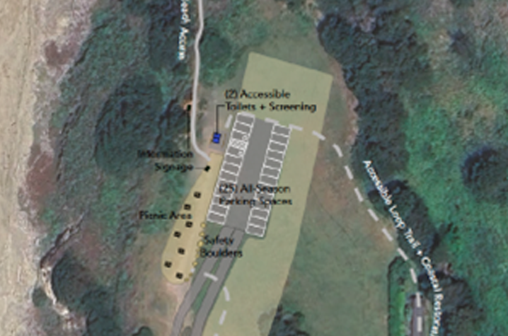
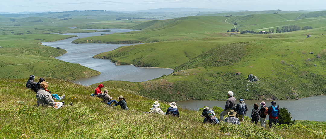
The Commission’s Transportation, Access, and Mobility Program also plays a significant role in developing habitat mitigation projects, primarily to address habitat impacts from transportation projects. As part of that, the program helps to preserve large areas or critical parcels of scenic coastland for habitat restoration, conservation, and coastal access. For example, at the Estero Americano Coastal Preserve the program worked with various entities to open new public access trails and develop extensive habitat restoration and enhancement on the 547-acre former Sonoma County ranch. The restoration includes the creation of new wetlands and the restoration of extensive native grasslands and other native habitats, while new trails enable access to the mouth of the Estero Americano for the first time.
The program also leads advanced mitigation efforts as part of a more formal statewide advance mitigation program, coordination around local mitigation banking efforts, and various ad hoc efforts to set aside coastal habitats for future mitigation efforts. Our program also played a key role in the Blues Beach transfer from Caltrans to the Kai Pomo Tribal non-profit, including associated habitat restoration, public access improvements, and tribal components.